It was time to move on again before the grass grew under our feet, or in boating terms, before the algae and slime grew on our bottom (boat’s “bottom”, not our bottoms.) Although we had said our goodbyes to Lynn and Alfred the evening before, they were waving to us and from their deck on the ICW.


We needed to refuel and also needed to wait for Causton Bluff Bridge opening, delaying our departure until 8:30 am. Our intention was to stay in the ICW the first day and then maybe go offshore the next day from Sapelo Sound to St. Mary’s Inlet and then Cumberland Island. We weren’t certain of our timing so it was possible that we would be in the ICW for the entire length of Georgia.

After the bridge and refueling, we passed Bonaventure Cemetery on our starboard side. Reminder – this is the cemetery where the Bird Girl statue lived until the fame of Midnight in the Garden of Good and Evil put her at risk and she was subsequently moved to the Telfair Museum. Bonaventure is a public cemetery located on a scenic bluff on the Wilmington River, a part of the ICW, and is considered to be the most beautiful cemetery in America. On our way north I hope that we can visit Savannah again and include a walk through Bonaventure in our experience.

We could not believe our eyes when we spotted this yacht covered with ….what is that? Al realized that the structure is for the “winter cover.” That is some winter cover!!

Dolphins!! We are seeing so many more dolphins on this trip than on our first one, and we never get tired of it. Sometimes I try to take photos, usually without success, but most of the time I just enjoy their beauty.

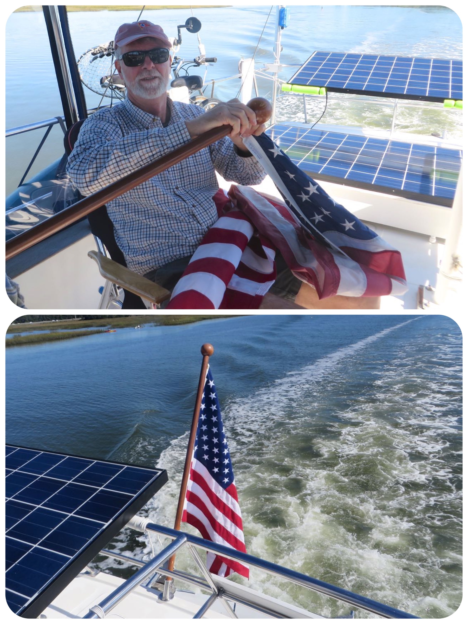
The American flag that came with the boat when we purchased her was rather worn and in poor shape. A gentle but thorough washing had cleaned the mildew, but the flag was shredding on the edges, and developing holes. That bothered us, especially since we fly the flag every day. With our planned trip home to Connecticut, we bought a new and stronger flag from the American Legion and had it shipped there.
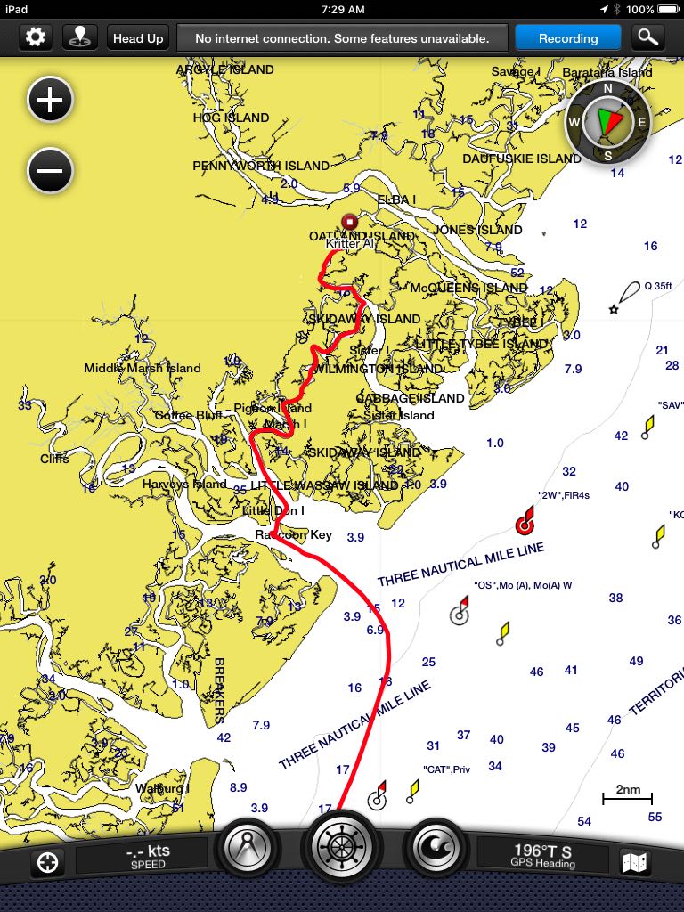
At 11:45 am we carefully transited Hell Gate, an ICW short cut in the Ogeechee River that passes between Little Don Island and Raccoon Key. The cut is a known “ICW Trouble Spot” because of the shallow depths at low tide. Georgia’s high tidal swings mean that the water could be as low as 3 feet at low tide, so timing is critical. Three feet is too low even for our trawler.
Once on the other side of the Ogeechee River we turned west to follow the ICW. At this point, now noon, we made a very impulsive decision and changed course. At that moment, several things came together for both of us –
- It is a beautiful day, and it looks like it is going to stay that way for at least 24-36 hours.
- We both had an itch to get out on the ocean again.
- Watching for shallows is tedious.
- The winding and meandering through Georgia’s ICW just wasn’t appealing today. We know this is beautiful stretch of the ICW, but ……
A quick study of the charts and inlets with an extended look at the weather forecast told us that it would be possible to go outside. Within a 10 minute time span, Kindred Spirit was turned around and heading east out Ossabow Sound to the ocean. Was this a good idea? After considering all factors, we felt comfortable with our decision. And I didn’t have to spend hours worrying about it ahead of time. I guess Nike has it right – Just Do It!


Now that we were outside, we had to figure out where we would return inside and when. Although I really wanted to stop at Cumberland Island again, it was obvious that it wouldn’t fit into this new plan because we would have to enter St. Mary’s Inlet in the dark of night. That does not appeal to us. It’s sometimes ok to leave in the dark, but entering and anchoring in the dark is not an option we like. Looking ahead, we determined that we could go straight to St. Augustine and be there by early morning. In fact, we would need to slow down at some point during the night so that our arrival would be in daylight.

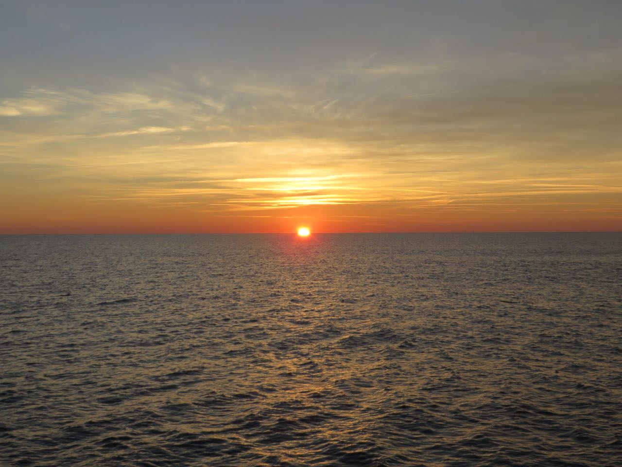
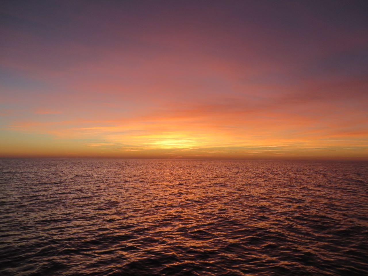
Sunrise and sunset are special times of the day, and even more so on the water. The sunset on the ocean with nothing else around, no land, no buildings, no man-made lights is simply magical. The colors change, the glow shifts, sometimes the colors are bright and sometimes they are muted, even in the same sunset.


For those of our boating friends who are “hard core” and do offshore overnighters all the time, please remember that we aren’t that experienced. I can count our offshore overnighters on one hand– 3 New Jersey ones (which were really only 13 hours that began in the darkness) and 2 previous trips across the Gulf Stream to the Bahamas. Hmmmm, I guess that would mean this time was only our 3rd true offshore overnighter. Still rookies. And this was the first time with the Mariner Orient 38.
We moved from the flybridge to the inside helm for dinner and the rest of the night to escape the chill and dampness of the night. We decided on two-hour watches. That’s a short watch period, most sailors do four-hour stretches. If this were a multiple day offshore run, four-hour watches would be better, but for the expected 22 hours, this would work for us. What’s important is that we decided what works for us. You can listen to all the advice from experienced cruisers, but in the end you really have to digest it all and do what works for you, as long as it is safe.
The instruments cast a glow at night, even in “night mode” so we covered them with a cloth to improve our night vision. Every 15 minutes, the person on watch checks everything – radar, chartplotter, autopilot, AIS, and looks 360 degrees around with eyes to confirm that everything agrees. We stayed about 15 miles offshore for most of the time, with only an occasional sighting of the lights from another ship. The ocean is big, even just 15 miles off the coast.

We listened to reports all night long on the VHF concerning a sailboat, Sea Popper, which had an electrical fire and was disabled 4.5 miles off Crescent Beach, Jacksonville, Florida. The Coast Guard sent a boat and helicopter out and was asking for assistance in locating the missing vessel. We never did hear what happened. Curious, and worried about the boat, I googled it the following day. Much to my surprise I read that the USCG now considers the Mayday call to be a hoax until there is evidence that a ship was actually in distress. The Coast Guard is trying to determine whether this call is connected to any other recent hoax calls off the coast of Northeast Florida. Really???? Why are there people who would do such a thing? (I guess that is a foolish and naive question.)
Our autopilot suddenly malfunctioned at 5:30 am during my watch. I was running through my checks and leaned across the instruments to see the radar and plotter better. Without realizing it, I was leaning on the autopilot control buttons which confused it, forced the rudder too far and for too long to the side, overloading the hydraulic steering pump, which blew the fuse. I did not know that at the time – “we” didn’t figure this out until after the fact. All I knew was that the boat was not behaving the way it should have been. What did I do? I yelled for the Captain! For the rest of the trip, we hand-steered without the autopilot until Al could investigate the problem properly.
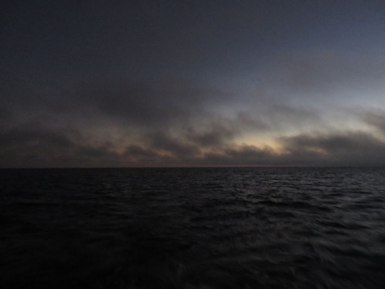
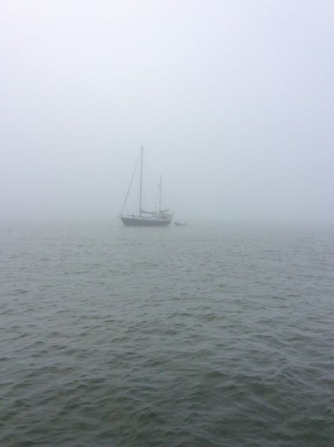
With some daylight beginning, we were close to entering the St. Augustine inlet. Except for one problem…….FOG. Morning fog had descended before the sun could even fully rise. I dread fog.
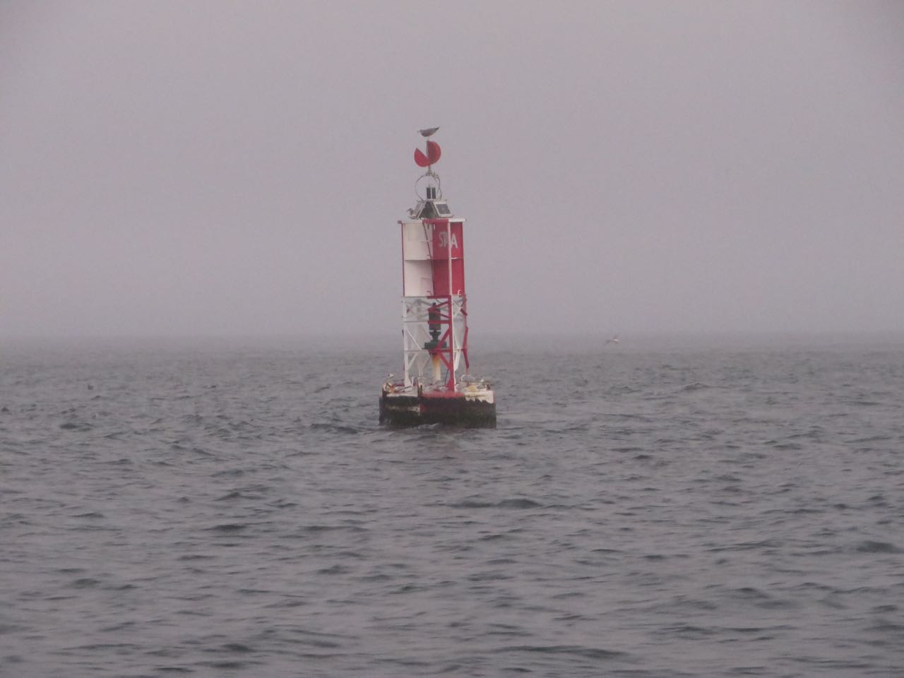
There are no red and green markers for the outside entrance on the chart because they are moved often due to shoaling, so the chartplotter doesn’t show them. It’s eyes only, IF you can see! We were each hanging our heads out the sides of the boat, searching the fog for the nuns and cans to guide us in.

Not so, the fog became thick and heavy. It is hard to steer straight in the fog without getting disoriented. Really missing the autopilot then.


As we creep through the channel through the fog, farther into the St. Augustine area, the markers are now on the chart and it was easier to find our way. We had to anchor because the city marina had no moorings available. We headed to a spot that our friends on Magnolia had told us about and anchored nearby a blue hull sailboat. I check the name out – Hi-Flite! We had met Cory and Dale in Connecticut while they were cruising in New England.
Our 22 hours/143 miles came to an end. We straightened things up around the boat and crawled into bed for a 2-hour nap. It felt good.
Leave a Reply