
Sailing the seas has a very complex technical side in the 21st century with tools that earlier sailors could not have imagined. As “small craft” and pleasure boaters, we only use a fragment of the technology used by the commerical and government sides.
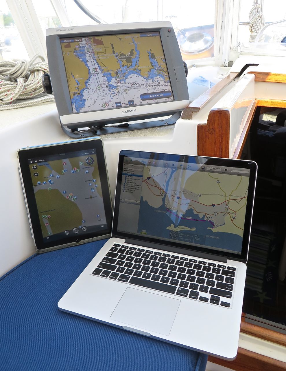
GPS (Global Positioning System) revolutionized boating before it became the norm for land use. We have used a Garmin 5212 Chartplotter with integrated radar for navigation since 2009 (birthday present for Al). Adding the Garmin Homeport app to the iPad and to my Mac will make plotting routes even easier for the trip. Active Captain is a web-based site and is integrated with Homeport to provide up-to-date information and reviews posted by other cruisers. There are reviews of marinas and anchorages, fuel prices, bridges, locks, stores, local knowledge, hazard information, and more.
Our helm has the traditional navigational tools. The compass is critical, even with all of the fancy stuff. The electronics at the helm include autopilot, speed, depth finder, wind direction and speed, and even water temperature. The VHF radio is the primary communication device for ship-to-ship and ship-to-shore.

We now have AIS (Automatic Identification System) which is an automatic tracking system used on ships for identifying and locating vessels by electronically exchanging data which identifies you, your position, and your track. Commercial vessels are required to have AIS. It is an additional tool in our toolbox to aid in avoiding collisions with other ships, especially the very, very big ones. An added feature is that we have incorporated it into this blog (see the “Where is Kindred Spirit” page) so that our location will show on the map (through www.marinetraffic.com) when we are transmitting. Less privacy? Sure, but there is no such thing as real privacy anymore; it’s only an illusion.
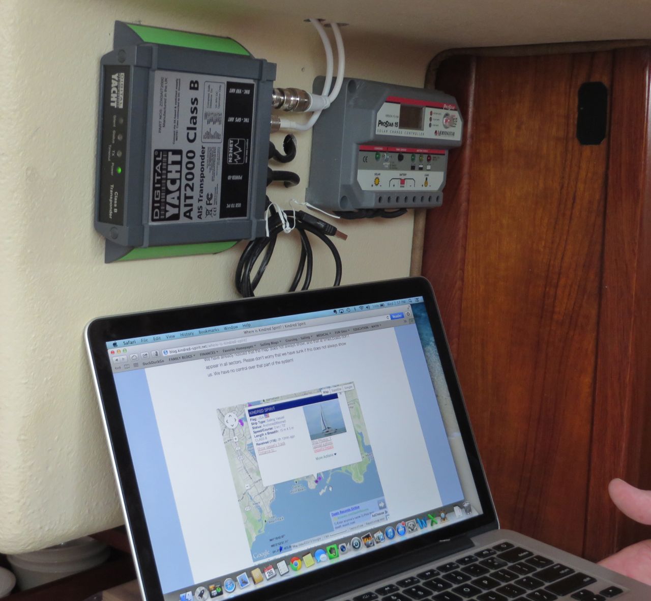
Next to the AIS device above, you can see our solar monitor. We have two 84 watt solar panels mounted on the hard top. Love them! They really help to keep the batteries charged. As long as the sun shines……
Today’s technology is awesome and does make things much easier. BUT, and this is a BIG but, it can fail. We have all experienced that. So we also have our paper – charts and guides.

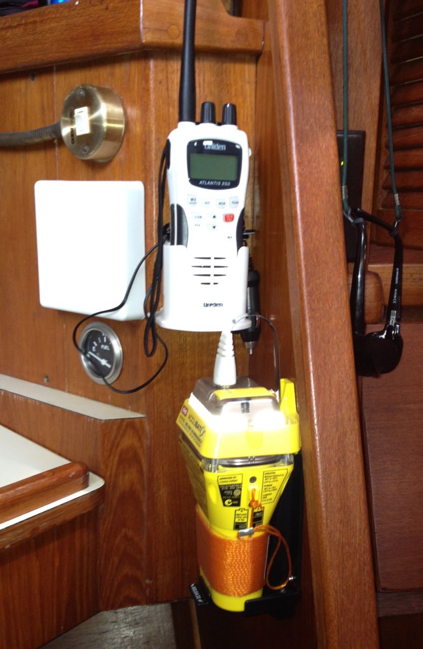
For additional safety, we also have an EPIRB now, mounted just below our handheld VHF radio. An Emergency Position Indicating Radio Beacon or EPIRB is used to alert search and rescue services in the event of an emergency. It does this by transmitting a coded message on the 406 MHz distress frequency via satellite and earth stations to the nearest rescue co-ordination center. We hope we will never, ever use this. If disaster does strike, we grab both the EPIRB and the VHF above it on our way off the boat. The “ditch bag” (or abandon ship bag) is also ready to grab quickly.
Only about 13 days left to prepare……………. still so much to do.
Here We Go Again! | Kindred Spirit
[…] last trip I described the technology we would be using while we cruised – Tech Talk 1 & Tech Talk 2. We are still using many of the same websites for advice, weather, and other boating/cruising […]
Chuck Bower
Steph and I are so excited you are both on your way at your new home.
Chuck