
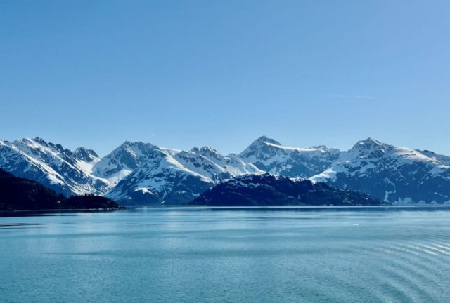
May 14th and we were back out in the Gulf of Alaska for a sea day before arriving in Glacier Bay, over 500 nautical miles to the south.

It was an overcast and cloudy day. The EXC presentation, “Ancestral Memories, The Past is Present” was especially good, probably the best one of the cruise. It was about the indigenous peoples of southeastern Alaska, the Tlingits and Haida, in their own voices.

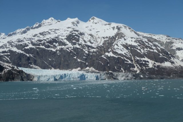
We awoke on May 15th to clear skies and sunshine, very welcome after yesterday’s fog and rain. In fact, it was a spectacular weather day. We were surrounded by glaciers but felt the warmth of the sun all day long.

National Park Rangers boarded the Nieuw Amsterdam in the morning and spent the entire day with us on the ship. Glacier Bay is one of 400 areas managed by the National Park Service. Dedicated as a National Monument in 1925, Glacier Bay was designated as a National Park in 1980. It has been a destination for visitors cruising on ships since 1890.
Glaciers are “rivers of ice.” Snow falls in the mountains, compacts into ice, and slides downhill. Each year, snow must fall to replenish the glacier.
Glacier Bay’s Glacier Statistics
- Number of glaciers: 1,045
- Longest glacier: Grand Pacific Glacier, 40 miles
- Fastest glacier: Johns Hopkins Glacier can move up to 15 feet per day.
- Area of Glacier Bay National Park covered by ice: 2,055 square miles, or 27%
Glacier Bay didn’t exist over 250 years ago. This sprawling valley was all glacier and no bay. A massive river of ice, 100 miles long and thousands of feet deep filled the deep basin surrounded by mountains. Beginning in the 18th century, the glacier started retreating up the branching valley. In 1750 the glacier had reached its maximum jutting into Icy Strait. Forty-five years later it had melted back 5 miles into Glacier Bay, gouged out by the glacier’s movement. Less than 100 years later in 1879, the glacier had retreated another 40 miles. Today, you must travel 65 miles up the bay to view the tidewater glaciers. This single collosal glacier has since shrunk to many smaller ones tucked within steep fjords, creating hundreds of miles of coastline and a new marine habitat.
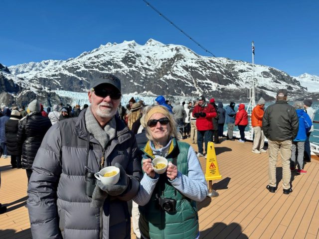
The views ALL DAY LONG were incredible. To be surrounded by this natural phenomena was an experience that won’t be forgotten, although the names of each glacier may be. I did not want to pause and take notes so I have forgotten a lot. 😞 We spent the day moving about the ship to see everything from different perspectives. The bow on Deck 5 was open for viewing and Deck 10 provided some awesome views, too. Honestly, even our own verandah was great for private viewings.


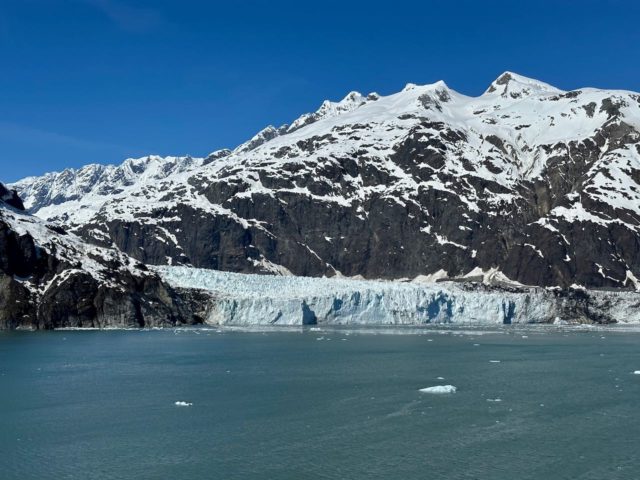
Majorie Glacier is all the way up at the head of Glacier Bay, 65 miles from the mouth. It is about 0.85 miles wide, with an ice face that is about 200 feet high above the waterline. The glacier is approximately 21 miles long and begins in snow-fields of the Fairweather Range where elevations exceed 9000 feet. The ice flows about 3-7 feet per day.
The ship stayed here for at least an hour and turned around and around so that everyone had views of the glacier. We changed our positions from port to starboard, fore to aft, just enthralled with it all.


Johns Hopkins Glacier is formed from numerous tributary glaciers, many of which extend 12 or more miles into the surrounding peaks. Debris can be seen in the ice face and extending up the glacier. This debris is transported in and on the ice and released either by the melting of the ice face or calving of icebergs into the Inlet.

Lamplugh Glacier sits at the entrance of Johns Hopkins Inlet.


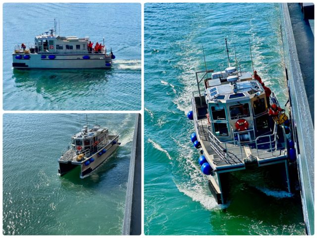
Then there was a bit of excitement. The Captain announced that a passenger needed to be evacuated so our journey’s continuation would be delayed while he was taken to shore. We got to see a lifeboat/tender put into action.

Another day came to an end. We never saw any calfing, but we were happy to see the glaciers and grateful to have had exceptional weather. At the rate of change and retreat these glaciers may not be here for the next generation.
Tom & Sue Sokoloski
Awesome pix! Thanks for sharing.