
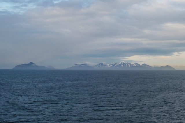
We had another sea day between Anchorage and our next port, Valdez. It is hard to wrap your head around just how immense Alaska is. Although Anchorage and Valdez don’t look that far apart on the chart, even driving inland would be 300 miles because the roads go around the Chugach National Forest.

We ate a leisurely breakfast in the main dining room and then took our laps the Promenade Deck 3.


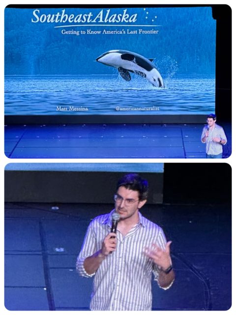
We took advantage of two different EXC presentations on this sea day. One was about commercial fishing in Alaska and the other was about the wildlife, ” The Nature of Southeast Alaska: Getting to Know America’s Last Frontier.”
Early on the morning of May 13th, the next day, the Nieuw Amsterdam arrived in the port of Valdez on the eastern side of Prince William Sound. Valdez (pronounced Val-deez) was named in 1790 after the Spanish Navy Minister Antonio Valdés y Fernández Bazán. The Good Friday Earthquake of 1964 caused an underwater landslide that washed away the waterfront area of Valdez and resulted in the loss of 32 lives. The resulting tsunami caused even more significant damage. The town was considered unsafe and homes were rebuilt on higher ground.
The city of Valdez receives an average of 300 inches of snow annually in town, at sea level. Nearby Thompson Pass sees 600 to 900 inches each year on average, and during some winters 100+ inches can fall each month for up to five consecutive months.


Our planned excursion for the day was a six-hour journey on a catamaran through Prince William Sound ultimately to view wildlife and the Columbia Glacier area. We were quite excited to get out on the water. Does that sound strange?

Ahh, kindred spirit? 😉
The Glacier Spirit headed out from the marina and into Port Valdez and Valdez Arm in order to reach Columbia Bay. The low hanging clouds soon dispersed and we had sunny skies although very chilly weather for the day. Captain Amanda maneuvered the catamaran to where wildlife could be seen and her crew, Nellie, Kara, Caleb, and others were on constant lookout for new sightings.

The first wild life spotted looked really relaxed and not all that wild. The cluster of specks on the water’s surface were sea otters. Sea otters usually swim or float on their backs while grooming, resting, or eating. Their dense luxurious fur was prized by Russian, American, and British fur traders in the late 1700s to the mid-1800s and nearly wiped out the sea otter population in Alaska and along the Pacific Coast. By 1850 just a few isolated groups remained, mostly in the Aleutian Islands. An international treaty passed in 1911 banned hunting and by the mid-1900s, otters had begun to recover from 200 years of killing. The sea otter population in Prince William Sound has been fairly stable since the early 2000s.


The views surrounding us were so different in each direction.

Valdez is well-known for the Trans-Alaska Pipeline System (TAPS.) Across the bay from Valdez’s picturesque waterfront lies the terminal where oil is loaded onto tankers for shipment to markets. The 800-mile-long pipeline, which runs from Prudhoe Bay to Valdez, brings the oil from northern Alaska to the Valdez Marine Terminal where tankers are filled with the crude oil to be transported to refineries.

Captain Amanda paused the Glacier Spirit to wait and see what an oil tanker ahead was going to do. This was a good moment to talk about the Exxon Valdez oil spill.

Most of us remember the Exxon Valdez oil spill. I remember it but had forgotten the details.
A few minutes past midnight on March 24, 1989 the oil tanker Exxon Valdez, carrying 53 million gallons of crude oil, struck Bligh Reef, a well-known navigation hazard in Alaska’s Prince William Sound. The impact of the collision tore open the ship’s hull, causing 11 million gallons of crude oil to spill into the water.

It was the worst oil spill in U.S. history until 2010. Initial attempts to contain the oil failed, and in the months that followed, the oil slick spread, eventually covering about 1,300 miles of coastline. Prince William Sound had been a pristine wilderness before the spill. The Exxon Valdez disaster dramatically changed all of that, killing an estimated 250,000 sea birds, 3,000 otters, 300 seals, 250 bald eagles and 22 killer whales. Over 30 years later, pockets of crude oil remain in some locations.

Various reports following the accident have identified several factors that made Exxon Valdez run aground on the reef under the command of Captain Joseph Hazelwood, but some people dispute the official versions.
According to reports, before handing over the ship’s controls to the Third Mate, Hazelwood had apparently altered the vessel’s course to avoid icebergs before handing control over to the third mate. Captain Amanda said that the autopilot was engaged and the 3rd mate, not realizing that, was unable to maneuver the ship to avoid Bligh Reef, a known hazard. Accusations of intoxication were lodged against the Captain who was asleep in his bunk when the grounding occurred. Hazelwood was acquitted of being intoxicated but was convicted of misdemeanor negligence, fined $50,000, and sentenced to serve 1,000 hours of community service.
Investigators pointed out that Hazelwood made a mistake by handing over the vessel’s helm to the sleep-deprived seaman, who was also not professionally qualified to take control of the vessel. In addition, investigations learned that the vessel didn’t have sufficient crew abroad to perform the duties and was not following the prescribed normal shipping routes and lanes. The National Transportation Safety Board (NTSB) blamed the Exxon company, its overworked crew, inadequate safety measures and carelessness shown at sea.

Although it isn’t a big part of our Alaskan journey, the Exxon Valdez is important to remember.


Humpback whales are born in the warm, protected waters of Hawaii. Baby humpbacks are born with only a small amount of fat so the water is too cold in Alaska. The humpbacks then migrate 3,000 miles from Hawaii to their summer feeding grounds in Alaska where they gorge themselves on small fish and krill, and return again to Hawaii in the winter to mate and give birth. The whales actually don’t eat at all in the southern waters. Adult humpback whales can be 43 to 52 feet long and weigh up to 80,000 pounds. Humpback whales are known for their songs. “The song is a loud, complex series of sounds repeated over and over. It occurs primarily during the breeding season, is sung only by males, and its composition changes as it is being sung with all singers in a population singing the same version at any one time.”


The ship slowed as it approached the southern end of Glacier Island so that we could watch the stellar sea lions that gather there. Look at them! They sun themselves and rest on the rocks, making bellowing sounds.


Leaving Glacier Island and the stellar sea lions behind, the Glacier Spirit began the journey into Columbia Bay. Prepare for a lot of ice photos because it was fascinating and educational. Were we in “Frozen” with Elsa and Anna, Kristof and Olaf???


It was hard to resist photographing the ice chunks. Each one is unique in color, size and shape. Why resist?


I’m like a kid so I got a big kick out of holding a piece of a glacier. Alas, there was no room for it in our suitcase……

You could really tell that Captain Amanda loves her job and glaciers. Shares her knowledge with such enthusiasm and reverence for nature. The glacier never fully melts, but freezes and the snow compresses into ice over hundreds of years, pressing the air out. When the mass becomes so large, gravity pulls it down to sea level. Glaciers take the easiest path, like a river, taking a loooong time to reach sea level. Columbia had advanced 40 miles out into what is now Columbia Bay, but it is now one of the most rapidly changing glaciers in the world. Since the 1980s, it has retreated more than 12 miles to the north which has given humans a rare opportunity to study and document glacier movement. The Columbia Glacier has also lost more than 50 percent of its volume, mostly due to calving.


At first we thought these swimming black and white bodies were orcas, but they were Dall’s porpoises. It was simply impossible to get a still photo, but a short video did the trick.
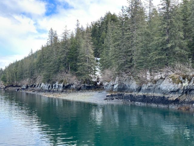
Entrance Island is a tiny bit of land marking the entrance from Valdez Arm to Port Valdez. There is a narrow path between it and the mainland and the boat went through.

Entrance Island on the left (port) and mainland on the right (starboard.)


Tom & Sue Sokoloski
Your photo “Exiting Entrance Island channel” could be the best one yet. Fantastic reading your blog!
watsons
It’s really difficult to choose a favorite photo from this trip.
Robert Dyer
Wow, you’re taking full advantage of the Alaska wilderness that’s for sure. Yeah I’ve never been that far north in Alaska just to glacier Bay on a boat and that was quite a long time ago. Yes I am biased but I do love South East Alaska and all the way down to the San Juan islands in WA. Kadey Krogen’s are an ideal boat in these waters. When you get back to BC Canada and if you want to stop in Bellingham (just 22 miles south of the border) I could treat you to mallards ice cream or if like local craft beer there’s 18 microbreweries to choose from ? thanks for sharing your trip with us. Bob and Kyra on the lady Grace.
watsons
It would be sooooo awesome to cruise in Alaska on our own boat, but that is definitely not going to happen. A bit too far to get there from here.
Barbara Pawloski
Wow amazing pictures!!!!! Loving your blog about your trip.
Susie Marshall
Wow! What an incredible excursion. Thanks for sharing.
Claire and Dick Taylor
What a wonderful blog! We so enjoyed your trip too Alaska! Thank you for posting all your blogs! We love them!